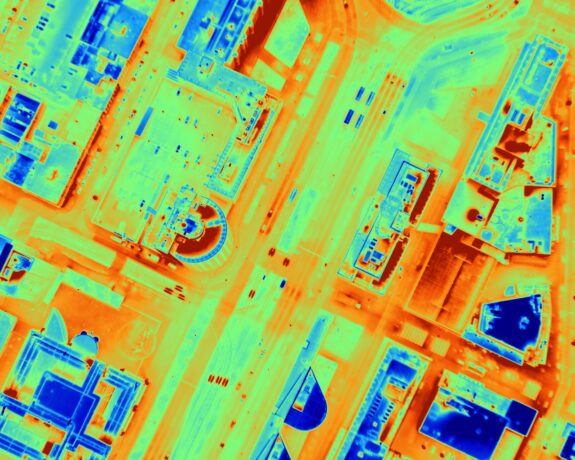
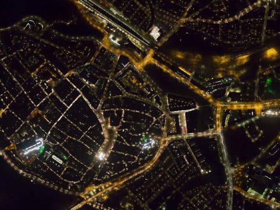
Thermal aerial photography

A thermal aerial photo visualizes heat loss through roofs of houses and other buildings.
By mounting a professional, cooled, thermal infrared camera vertically in an airplane, thermal imagery is captured whilst flying. Temperature differences can indicate energy loss. Flights are best performed in the wintertime, after sunset, when the differences between indoor and outdoor temperatures result in the best image quality. Combined with regular aerial photography and building outlines, a thermal image gives a clear picture of heat loss at an individual building level.
Thermal aerial photography enables you to:
- As a government, create awareness with citizens and building owners to take action in saving energy.
- As a local government, building owner or housing corporation, prioritize building upgrades.
In addition to the thermal aerial images we can provide online acces to images via our own dedicated webserver. We can also organize information gatherings for citizens or companies in your area.
Thermal aerial photography (previously called: Roofscan) has been developed in the Netherlands by Miramap Aerial Surveys and was first used in 2008, for the City of Nijmegen. Since then, several large projects have been successfully performed and delivered, including Amsterdam, London and Osnabrück.
Therm-o-bliqueTM
In addition to vertical thermal aerial photos, we also offer Therm-o-bliqueTM. Oblique thermal aerial photos visualize, besides the energy loss through roofs, the energy loss through facades. Therm-o-bliqueTM can also be used to detect heat islands under canopies and cool islands under trees.
Other purposes
We also deliver thermal aerial imagery for other purposes, such as:
- Detection of (underground) warm pipes and cables, or localize high voltage cables
- Visualizing urban heat islands and cool islands in cities
- Detection of illegal grow houses (hennep)
- Inspect the operation of rail switch heaters
- Count birds and other (wild) animals
- Detection of discharge of waste water
- Detection of water seepage areas for levees
We can simultaneously collect thermal aerial photography with aerial photography by night. Contact us for more information.
Some examples of our thermal aerial photography projects (in on-line viewer):
Thermal aerial photography Gemeente Midden-Delfland